TideHelper

For anglers and boaters · the whole US coast · free

Know exactly where you are in the tide.

Open TideHelper anywhere on the US coast and it tells you the stage of the tide at your spot, how long it keeps running, when the best fishing is, and what the current and wind are doing. Save your spot and it opens right there every time.

  • 4,092 NOAA tide stations
  • 856 current stations
  • 0 bars of signal needed
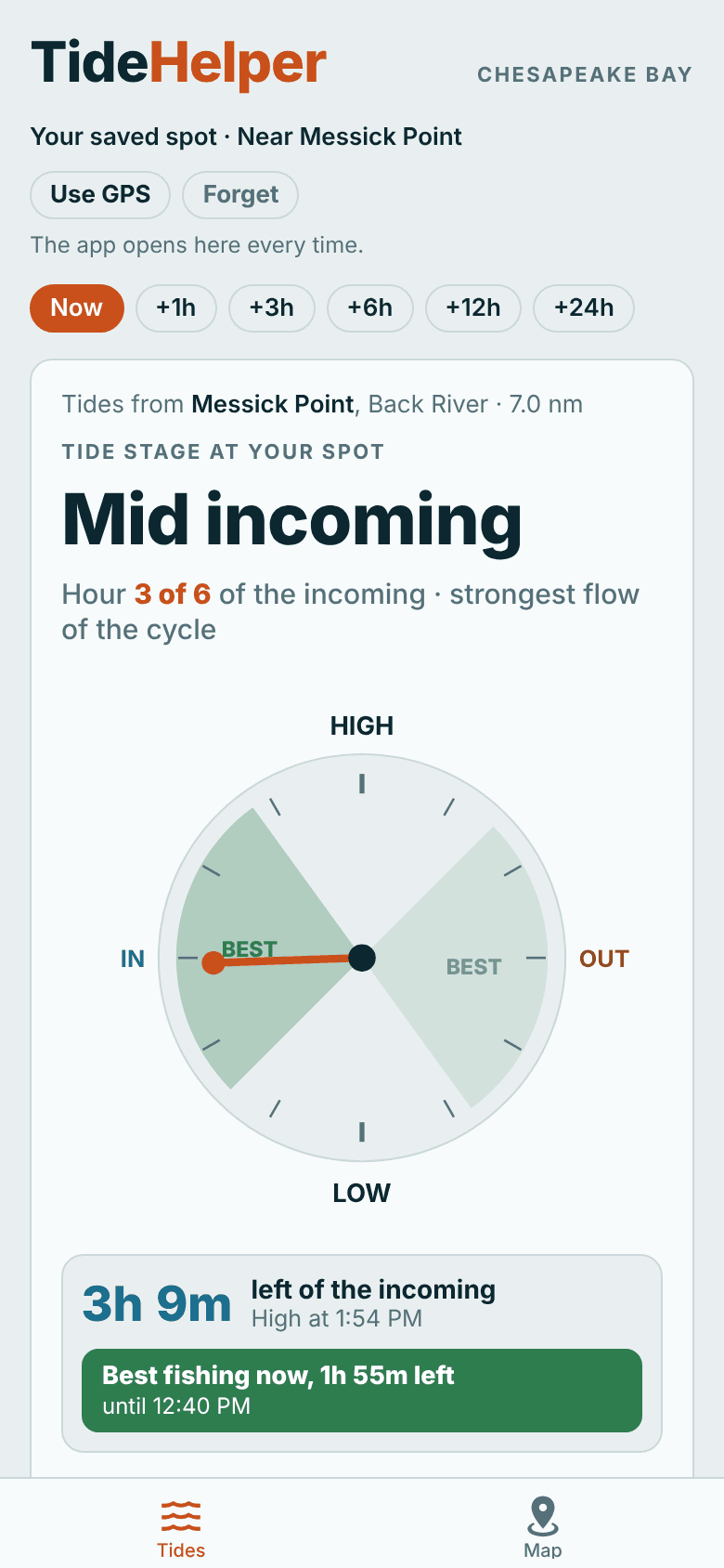
TideHelper opened at a saved spot near Messick Point: mid incoming, hour 3 of 6, on the tide clock with the best fishing shaded

Try it

The tide right now.

This is the actual TideHelper engine running in your browser. It takes the harmonic constants NOAA publishes for a station and works out the water level minute by minute, with no tide website or network call behind it. The app does the same thing on your phone, for every NOAA station on the coast, which is why it keeps working when you lose signal out on the water. Underneath, today's National Weather Service wind is set against the current to show whether it's calm or rough, and the fish filter shows the best times today for the fish you pick.

Live now

Hampton Roads (Sewells Point)

Working out the tide…

Tides and current computed in your browser from NOAA harmonic constants, the same engine the app uses offline. Wind from the National Weather Service forecast. Eastern time.

Tide stage

Where you are in the tide, and how long it's got.

TideHelper reads your GPS, picks the right NOAA station and tells you the stage in the words you already use: hour 3 of the incoming, strongest flow of the cycle. The tide clock shows it at a glance, with the best fishing shaded on the dial, the stretch where the water really moves. Right under it, a countdown says how long this tide keeps running and how long the best fishing lasts.

  • 3h 9m left of the incoming, high at 1:54 PM
  • Best fishing now, 1h 55m left, or when it starts if you're early
  • Save your spot and the app opens there every time
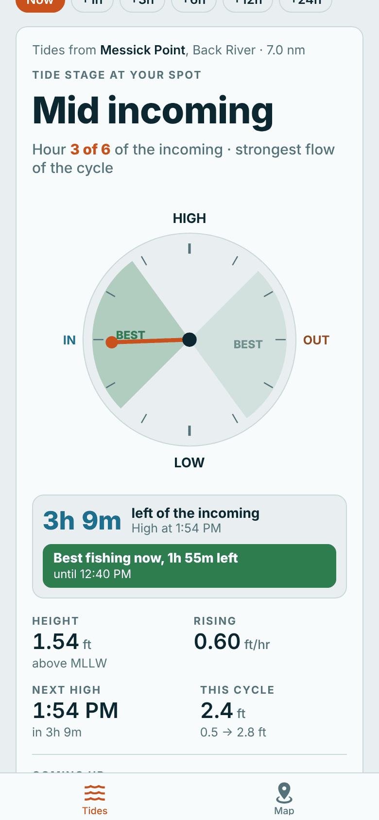
Tide clock at Messick Point in mid incoming, with the best-fishing wedges shaded and a box reading 3 hours 9 minutes left of the incoming, best fishing now, 1 hour 55 minutes left

Current

Slack water isn't high tide.

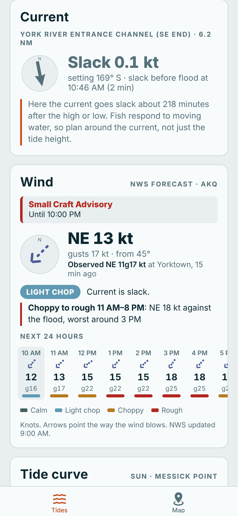
Fish feed on moving water, and in a lot of places the current keeps running long after the tide turns. TideHelper puts the nearest current station beside the tide: flood or ebb, speed in knots, which way it sets, and when it goes slack. Then it works out how far slack lags the high or low at your spot, so you plan around the water that's actually moving.

  • At the York River entrance, slack comes over three hours after the turn
  • Swipe the tide curve a week back and ahead, with flood and ebb bars underneath
  • Tap any moment on the curve for the height and current
Current card at the York River entrance showing slack, 0.1 knots, with the next slack before flood, and the wind card below

Wind and rough water

Wind against the tide, called hour by hour.

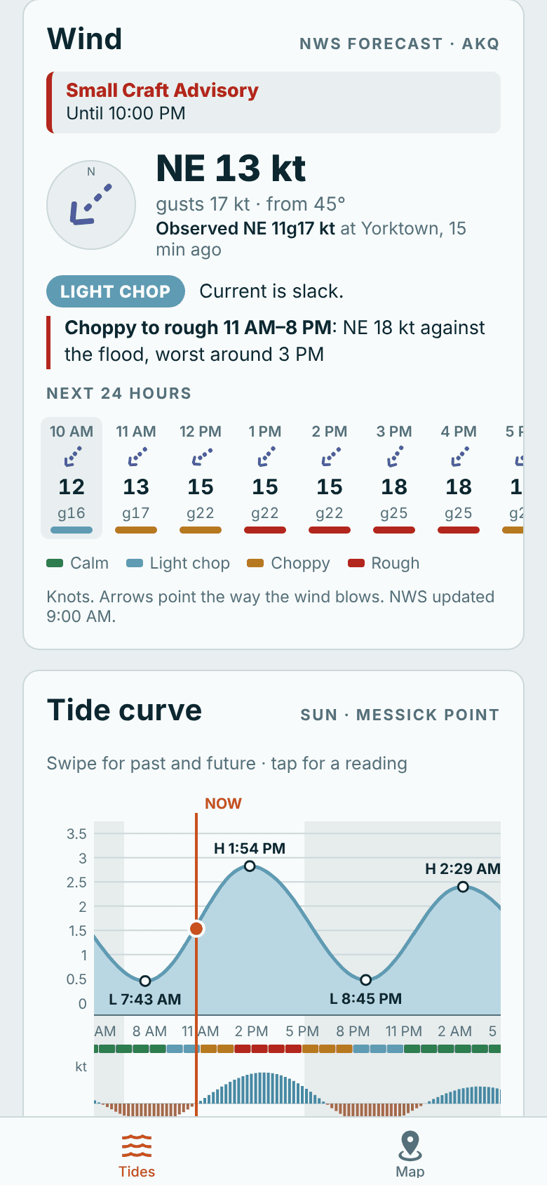
A weather app tells you NE 15. It can't tell you that NE 15 against a running flood stacks up a short, steep chop, or that the same wind lies down an hour after the ebb starts. TideHelper knows which way the current is running every hour, so it puts the National Weather Service wind next to it and works out when it'll be calm and when it'll be rough. It also shows what the nearest NOAA gauge is actually reading and any Small Craft Advisory.

  • Hourly wind, gusts and direction in knots, with measured wind beside the forecast
  • Calm to Rough, hour by hour, from wind against or with the current
  • Air temperature, clouds, rain chance and waves, plus marine advisories
Wind card with a Small Craft Advisory, NE 13 knots gusting 17, and a warning: choppy to rough from 11 AM to 8 PM with the wind against the flood

Fishing outlook

A bite forecast that counts the wind.

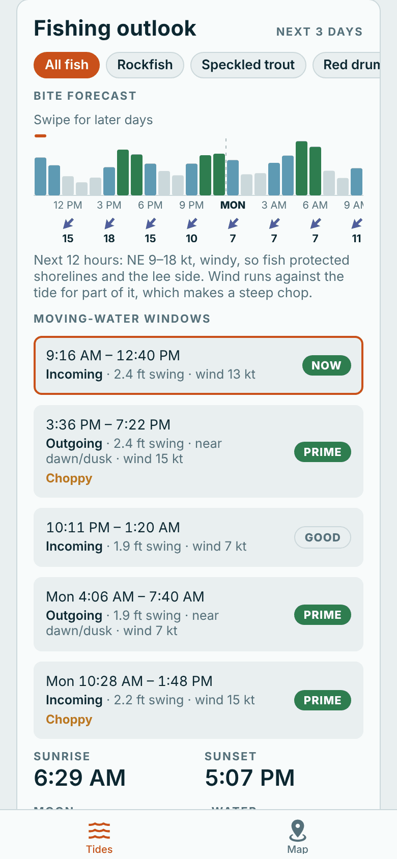
TideHelper scores the next three days hour by hour from the tide stage, the light, the size of the swing and the wind, then lists the moving-water windows and marks the prime ones. A light breeze helps. A blow that makes it hard to hold the boat doesn't, so a window that's blown out says Windy instead of Prime. Sunrise, sunset, moon phase and the water temperature sit alongside, with tips for the stage you're in and the season.

  • Hour-by-hour bite forecast with the wind underneath
  • Moving-water windows with the size of each swing and the wind
  • Live water temperature from the nearest NOAA gauge
Fishing outlook with an hourly bite forecast and wind arrows, and moving-water windows marked Now and Prime

Fish filter · Chesapeake and Charleston

Pick your fish. Get its best times.

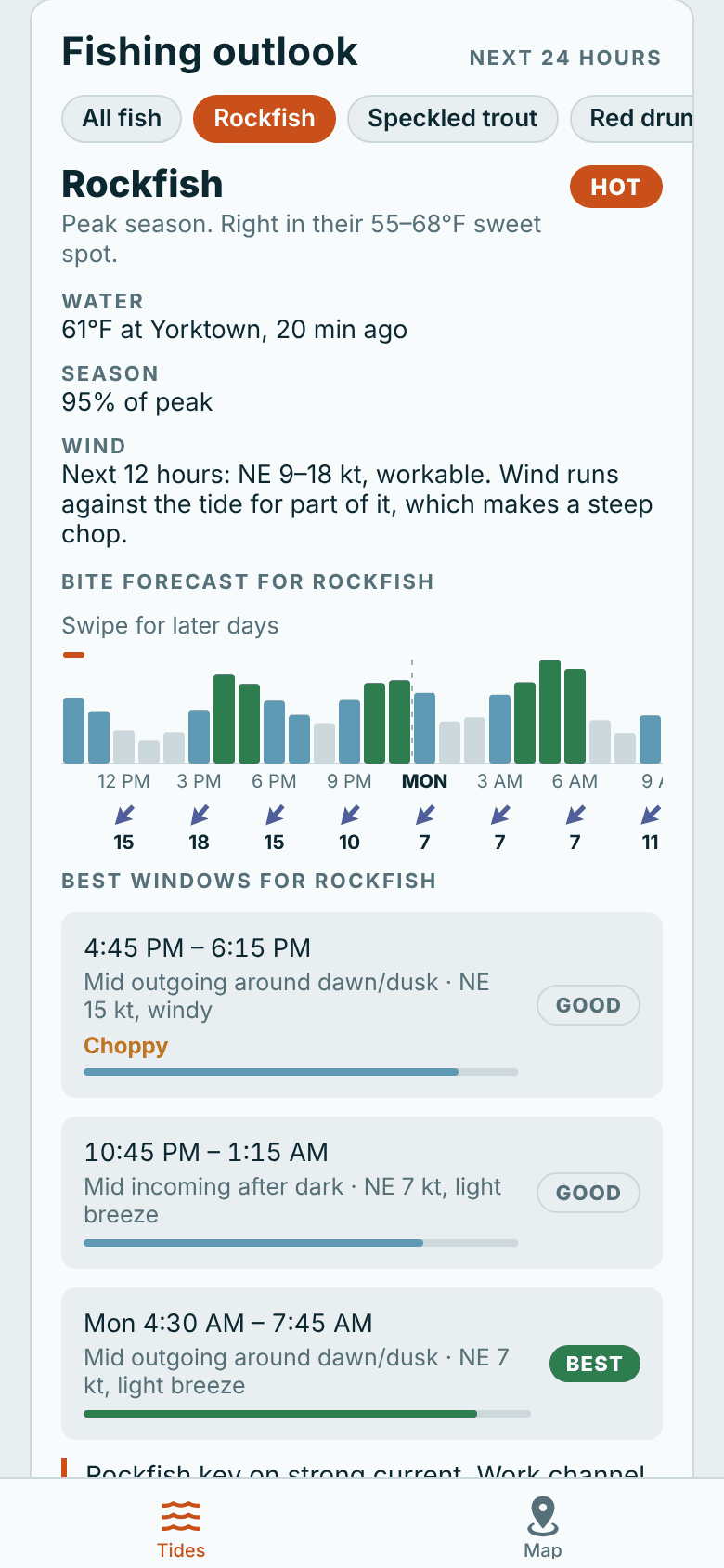
Rockfish want hard-running current and a breeze on the rips. Sheepshead are easier around the turn on a calm day. Flounder sit on the drop-offs on falling water. On the Chesapeake Bay and around Charleston, pick the fish you're after and TideHelper re-ranks the next 24 hours around what that fish likes, then rates the day from the season, the water temperature and the wind.

  • Day rating from Hot to Out of season
  • Its own bite forecast and best windows, with the reason for each
  • Local tips and links to the Virginia, Maryland and South Carolina size and creel rules
Fish filter with rockfish picked: rated Hot, 61°F water at Yorktown, wind for the next 12 hours, an hourly bite forecast and the best windows

The map

Wind, current, tide and weather. All on one map.

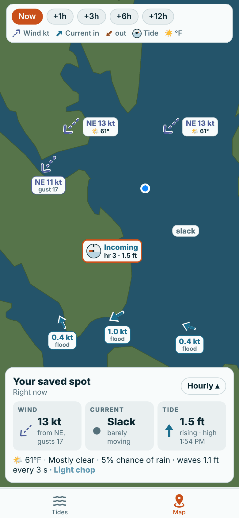
Everything shows at once, and nothing piles up: the marks space themselves out, and zooming in shows more. Tap anywhere on the water to see what it's doing there, then make it your spot with one tap.

Wind
A dashed arrow pointing where the wind is blowing, with the direction and speed in knots: NE 13 kt. Forecast marks add the air temperature and sky; outlined marks are measured at a NOAA gauge.
Current
A solid arrow pointing where the water is going, blue on the flood, brown on the ebb, bigger when it's running hard.
Tide
A little tide clock at each station: incoming or outgoing, which hour of six, and the height. The station you're using is ringed in orange.
When
Now, or jump ahead 1, 3, 6 or 12 hours and watch the wind and water change.
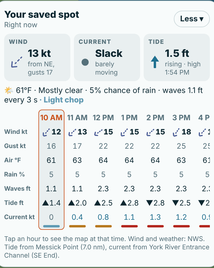
Spot panel: wind 13 kt from NE gusting 17, current slack, tide 1.5 ft rising, 61°F mostly clear, waves 1.1 ft, and an hourly table of wind, gusts, air temperature, rain, waves, tide and current
The panel under the map: your spot now, and hour by hour.
TideHelper map of Mobjack Bay with dashed wind arrows reading NE 13 knots and 61 degrees, current arrows on the flood, and a tide clock mark reading incoming, hour 3, 1.5 feet

Coverage

The whole US coast.

Every NOAA tide station in the US and its territories is built into the app, from Maine to Texas, the West Coast, Alaska and Hawaii, tidal rivers and creeks included. Lakes and rivers above the tide line don't have tides, and the app says so instead of guessing.

Every station

NOAA tide stations in the app

East Coast
2,000+
Gulf Coast
~790
West Coast
~580
Alaska
~580
Hawaii and Pacific islands
~70
Puerto Rico and Virgin Islands
~70

Plus 856 current stations, from Penobscot Bay to the Golden Gate and Cook Inlet.

Local knowledge

Chesapeake Bay and Charleston, SC

Here the app goes further: a fish filter for rockfish, speckled trout, red drum, flounder, cobia, sheepshead and more, local tips by tide and season, and links to the VMRC, Maryland DNR and SCDNR size and creel rules.

Everywhere else you get tips for the tide stage and season, with more local waters coming.

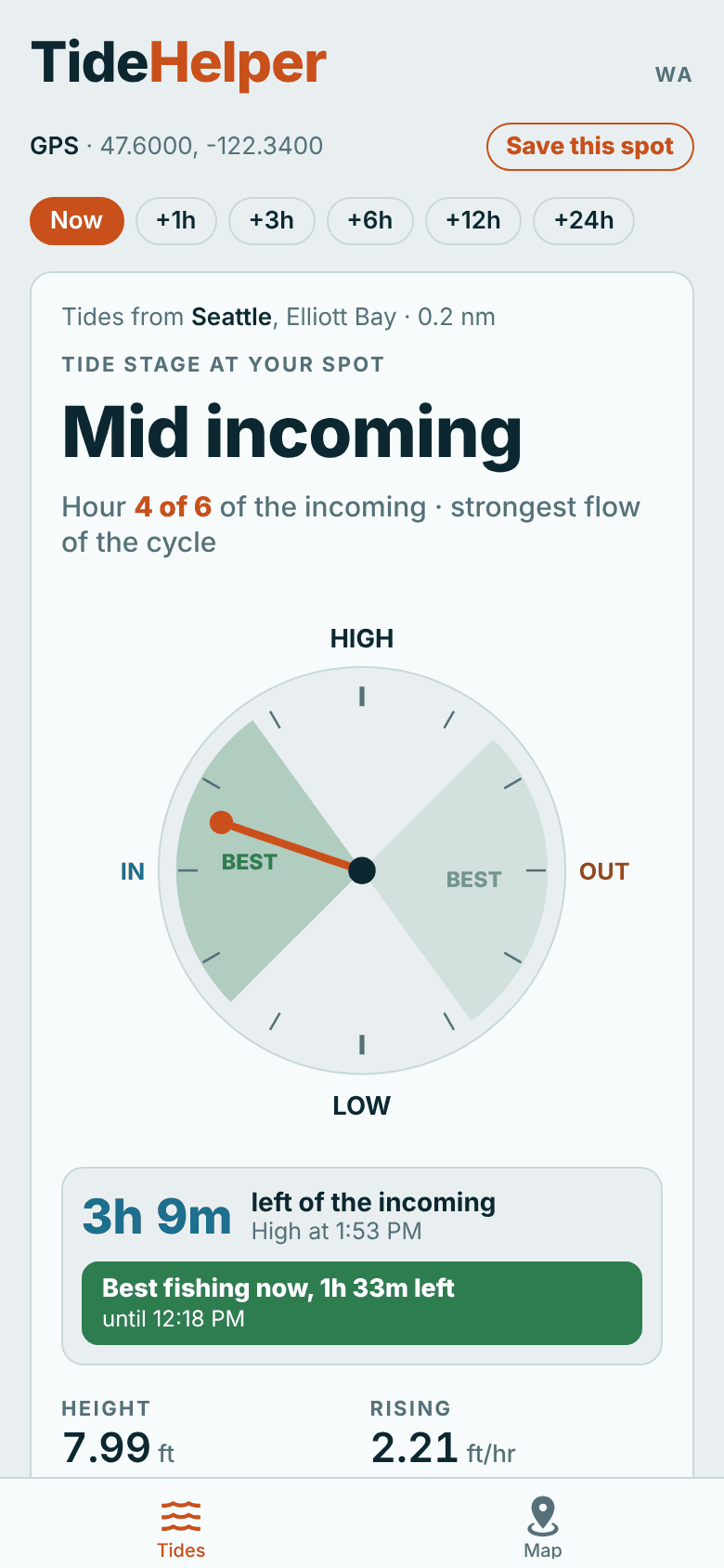
TideHelper in Seattle on Elliott Bay: mid incoming, hour 4 of 6, best fishing now
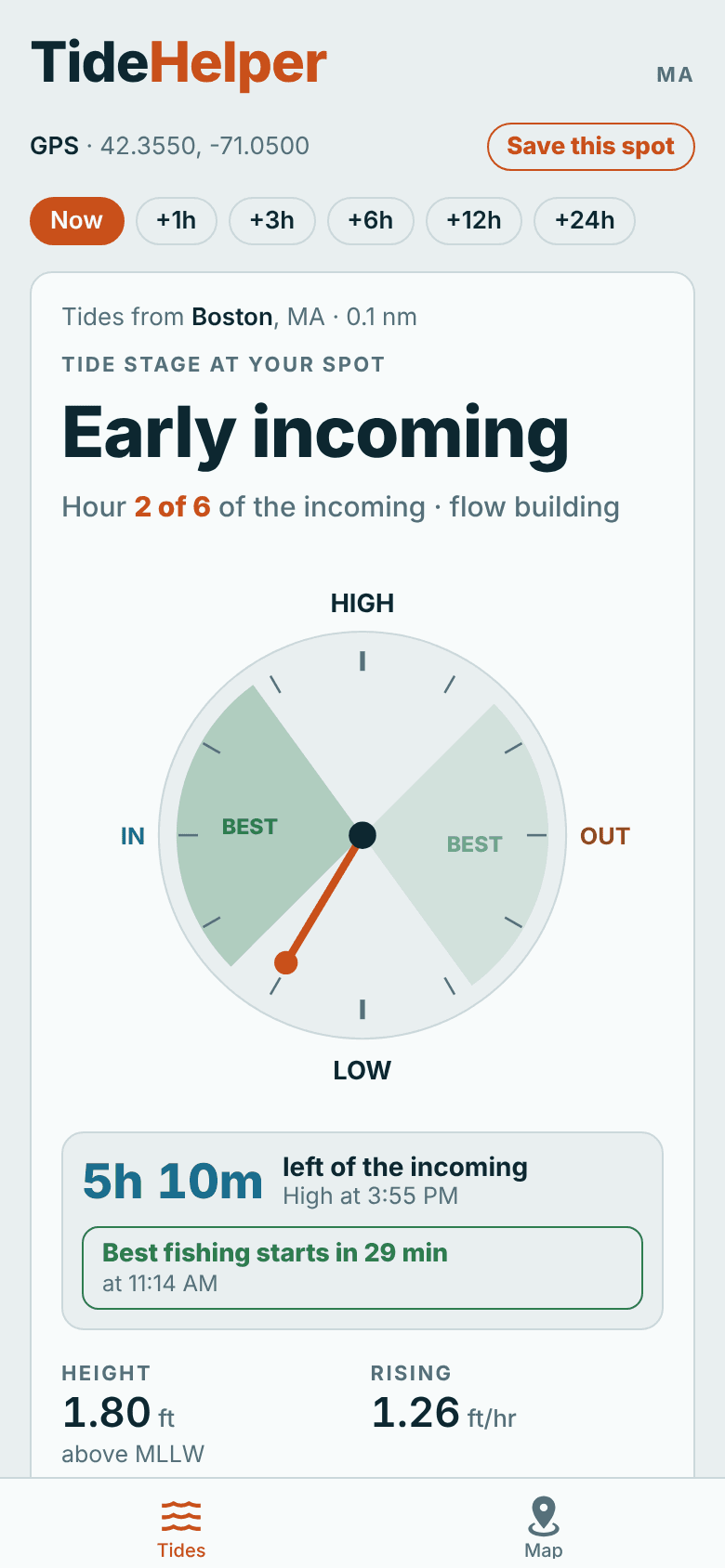
TideHelper in Boston: early incoming, hour 2 of 6, best fishing starts in 29 minutes

Works where your signal doesn't.

Every tide and current prediction is calculated on your phone from NOAA harmonic constants, and the last wind forecast is saved for the trip. No signal, no problem: the tide, the current and the clock keep going. Light and dark mode, so it's easy on the eyes before sunrise.

  • On-device tide and current math
  • iPhone on the US App Store
  • Private location only while it's open, your spot stays on your phone

Price

Free. All of it.

Everything in the app today is free, with no ads, no account and no sign-up.

TideHelper

$0

No ads. No account. Works offline.

  • Tide stage and tide clock at your spot, anywhere on the US coast
  • Best-fishing shading and a countdown for the tide that's running
  • Current: flood, ebb, speed and slack times
  • Tide curve a week back and ahead
  • Wind forecast, measured wind, marine advisories and rough-water warnings
  • Hourly bite forecast and moving-water windows
  • One map with wind, current, tide and weather
  • Save your spot, and the app opens there every time
  • Fish filter on the Chesapeake Bay and around Charleston

Coming in TideHelper Pro

For the days you're on the water.

Pro is the next step: the app keeping an eye on the water for you, planning further ahead, and remembering what worked. It isn't for sale yet, and the price will be set when it launches.

  1. 1

    Alerts that come to you

    A heads-up when it's going to be rough at your spot this afternoon, when your best window starts in an hour, or when a Small Craft Advisory goes up.

  2. 2

    Plan the week

    Seven days ahead at several saved spots, with the best window, the wind and the water for each day.

  3. 3

    A trip log that writes itself

    Trips that start and stop on their own, catches in one tap with the tide and wind saved, and after a few trips, the stages and currents your fish actually came on.

  4. 4

    Trolling depth

    How deep every rod in your spread runs, from your GPS speed with the tide's current taken out, and how much line to let out for the depth you want.

  5. 5

    Your fish, on more water

    The fish filter, local tips and regulation links for more of the coast, starting with the busiest fishing grounds.

Also on the way

In the free app.

Marinas and ramps

Nearby marinas, ramps and bait shops on the map.

Buoys on the water

Live wind and waves from coastal and offshore buoys, plus a short-range model for sea breezes and fronts.

Android

TideHelper is on iPhone first. Android is next.